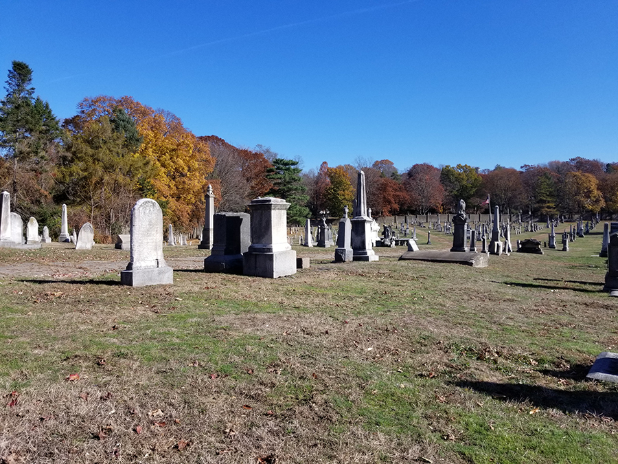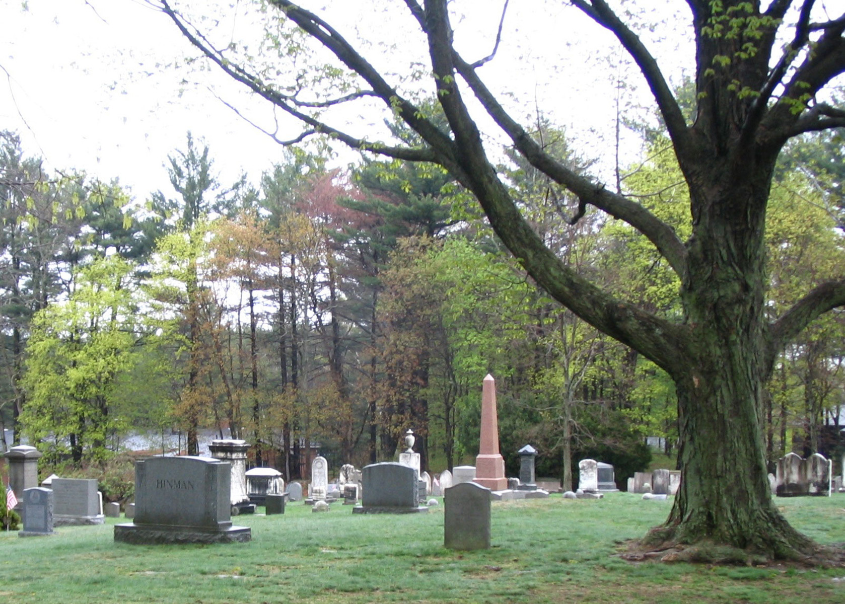
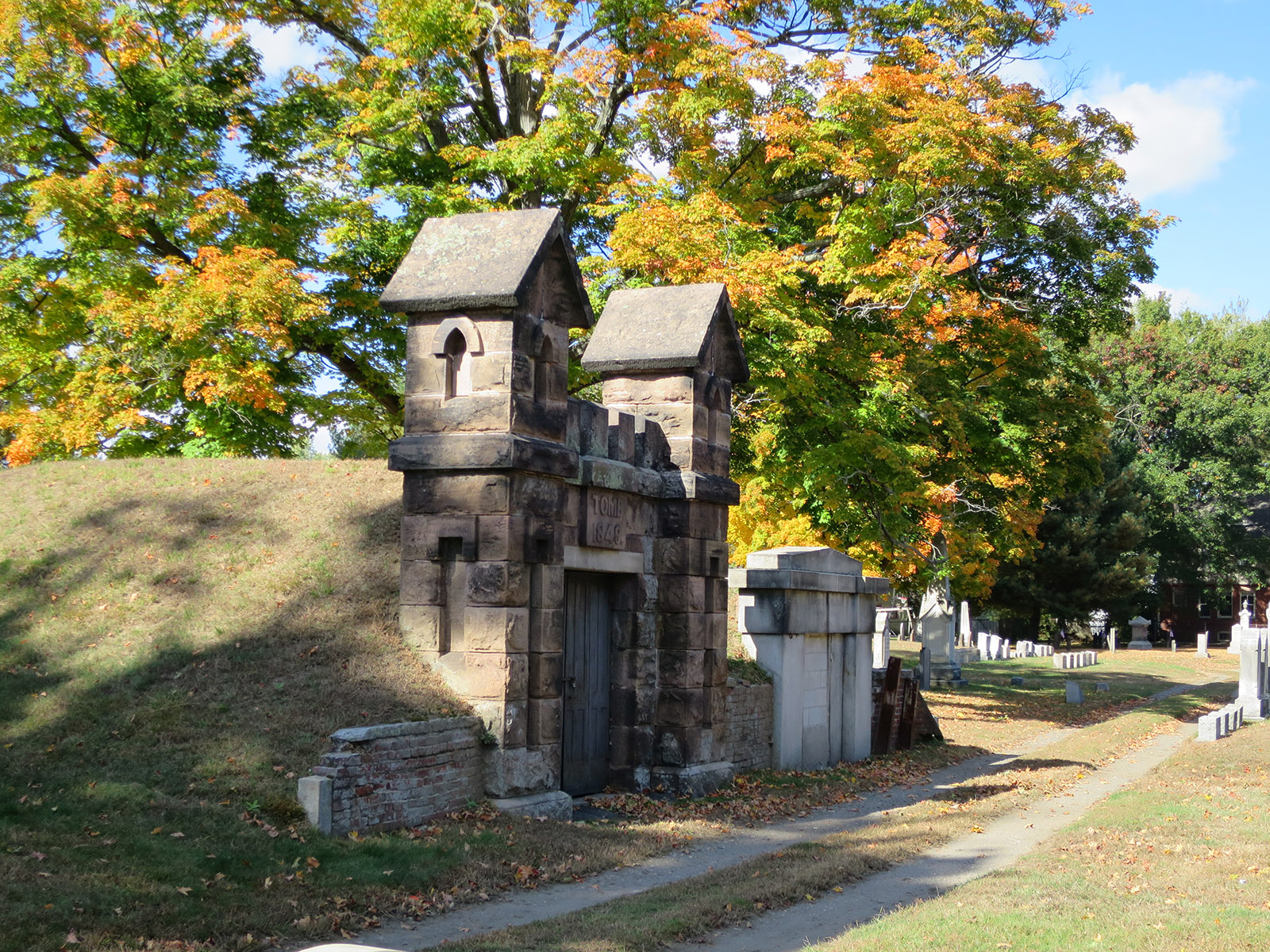
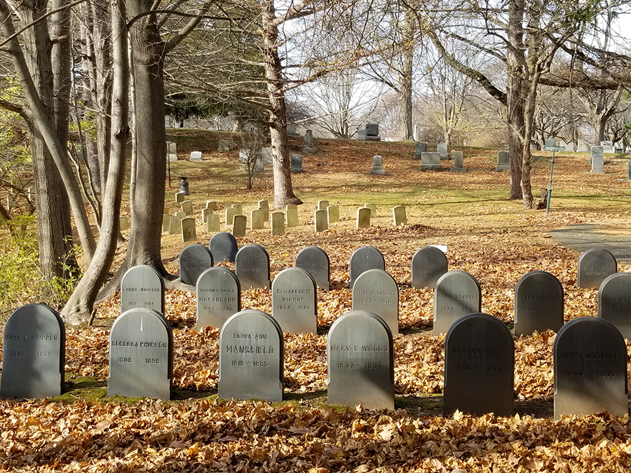
Chapel Cemetery is one of the most historic parts of the Phillips Academy campus. Established in 1810, the cemetery originally stood on one acre at the edge of the Andover Theological Seminary, and may have first served as a family burial ground for a nearby farm. Today, it is part of the Phillips Academy campus, providing a resting place for principals, faculty, students and other individuals associated with both the Seminary and Academy. Over the last ten years, the Trustees of Chapel Cemetery had become increasing concerned about the long term health of the Cemetery's landscape. The campus had grown, and the cemetery environs had changed. The Trustees recognized the need for a preservation plan that would guide future efforts to upgrade the environs, enhance the historic features, and provide for new commemorations. They hired Martha Lyon Landscape Architecture to lead the preservation planning process, an effort that included research, mapping, assessment, and development of preservation recommendations. In 2011, MLLA completed a detailed plan to restore the cemetery’s southwest entrance.
One of the premiere historic sites in Concord, Sleepy Hollow Cemetery is known throughout the world as the resting place of Ralph Waldo Emerson, Nathaniel Hawthorne, Henry David Thoreau, the Alcott family, and Daniel Chester French. It is the work of pioneer landscape architect Horace WS Cleveland, and with its steep topography, long vistas, stone retaining walls, cobblestone paths, exquisite sculpture and grand shade trees, exemplifies the 19th century Rural Cemetery Movement. The Concord Cemetery Commission asked Martha Lyon Landscape Architecture to prepare alternatives for treating the edge of Sleepy Hollow’s most prominent landform, the “hollow.” Using digital photography, MLLA documented existing conditions, and superimposed three design options on the photographs. The simulation allowed the commissioners to visualize the best approach for enhancing the cemetery’s street appeal.
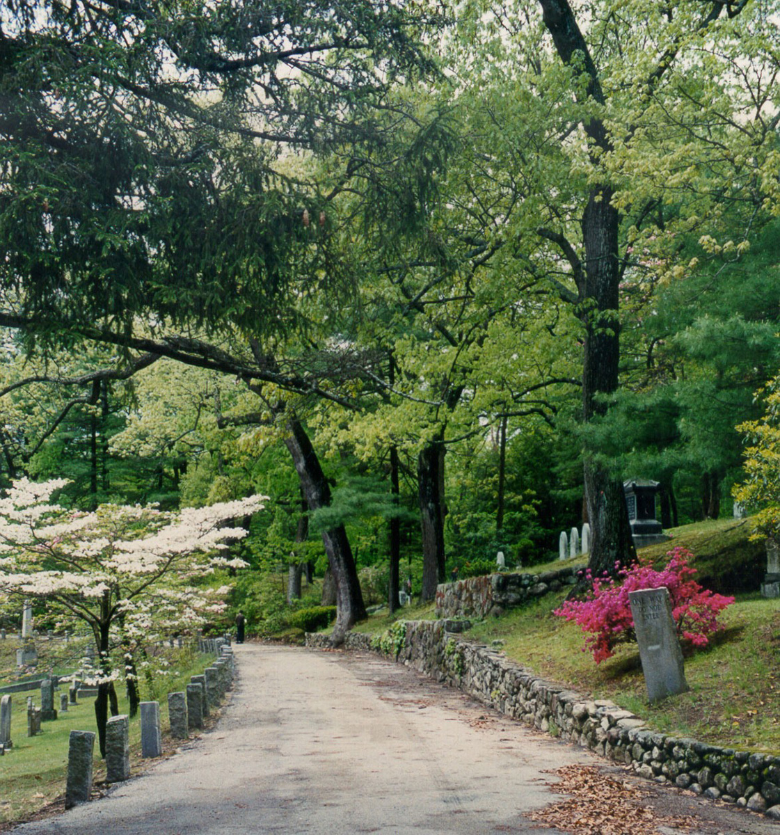
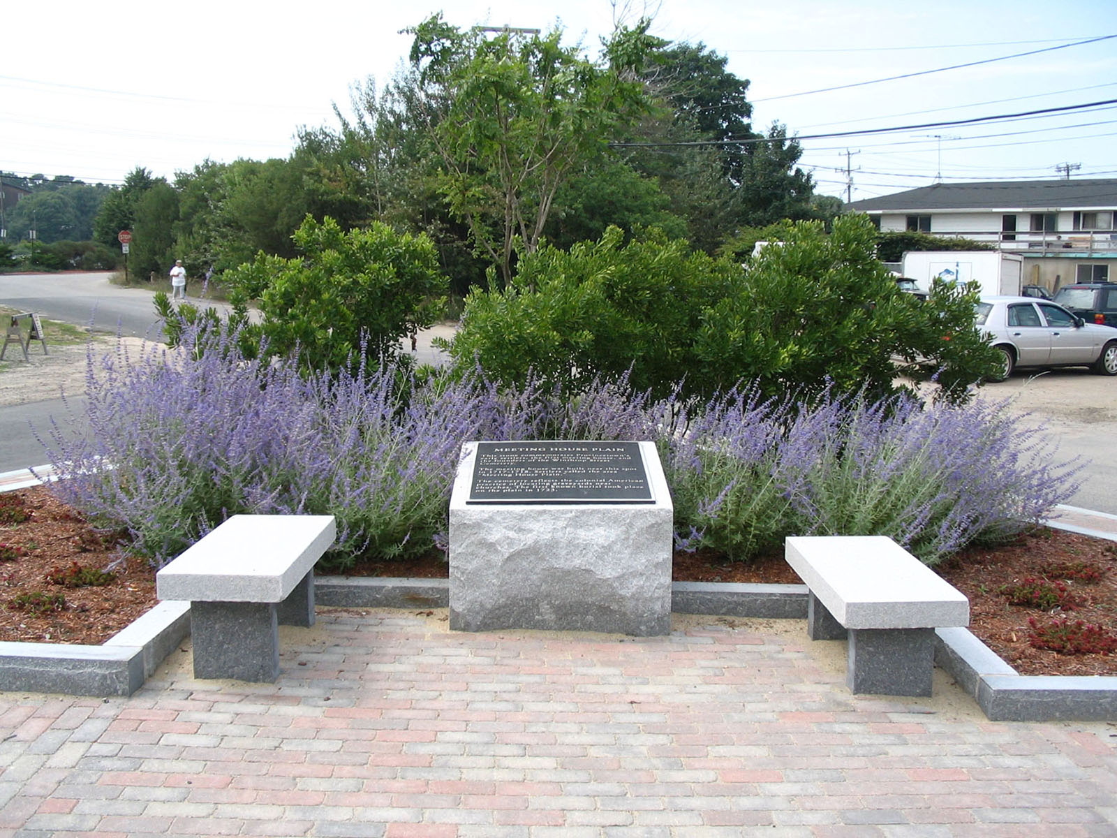
Provincetown’s oldest known place of interment, the Winthrop Street Cemetery, lies at the intersection of Winthrop and Court Streets at the northeastern end of the village. Established in the early 1700s, the 2.75-acre landscape straddles a forested dune, and contains over 500 marked burials. As follow up to a master plan completed in 2001 and 2002, Martha Lyon Landscape Architecture, LLC is leading an effort to advance dune restoration and gravestone conservation. Working collaboratively with Monument Conservation Collaborative, LLC (stone conservators) and CME Associates (consulting engineers), MLLA is preparing a master conservation plan for the cemetery, with detailed specifications for stone treatment and dune stabilization/restoration.
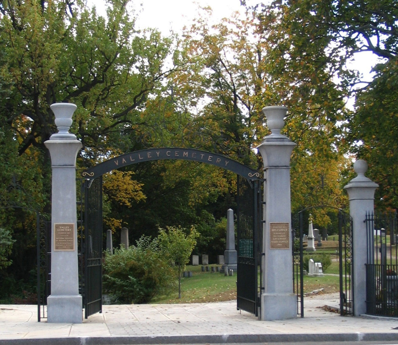
Nestled into the heart of downtown, near residential neighborhoods and a civic arena, Valley Cemetery traces 162 years of Manchester's history. A city-owned 19.7-acre property, the cemetery holds the graves of prominent industrialists, city leaders, factory workers, and children. A typical "Rural Cemetery" style landscape, Valley Cemetery features dramatic topography, grand historic trees, and high style architecture and funerary art. Martha Lyon Landscape Architecture, LLC led a multi-disciplinary team of consultants who prepared a preservation master plan for the landscape. The team prepared assessments and made care recommendations for the architecture, monuments, markers, retaining walls, trees, pathways, entry gates and fencing. Schematic designs offered concepts for introducing new burial areas, and budget projections provided guidelines for fundraising. Following completion of the Preservation Master Plan for Valley Cemetery, the City of Manchester and Friends of Valley Cemetery hired Martha Lyon Landscape Architecture, LLC to oversee the first phase of implementation. With a combination of public and private funding, the cemetery's main entrance off Auburn Street was restored to its original form. MLLA prepared construction documents and managed the treatment of the historic wrought iron gates, granite gate posts, and cast iron fence. Other improvements included reconstructing the concrete entry pavement and historic scoring pattern, introducing chip seal roadways inside the gate, and place street lighting and signs. The project received an Historic Preservation Award of Merit from the Manchester Historic Association in May of 2005.
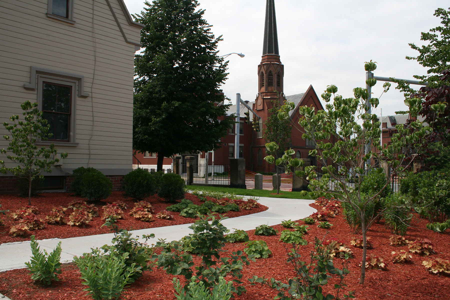
Grace Episcopal Church established a nine-acre cemetery between 1834 and 1836, next to Providence's South Side neighborhood at the intersection of Broad Street and Elmwood Avenue. The cemetery became the resting place of mill workers, war veterans, political leaders, and members of the area's many ethnic communities. Today, it holds an important place in the history of Providence and the people who built the city. In 2008, Martha Lyon Landscape Architecture, LLC prepared a preservation master plan for the historic cemetery. MLLA researched the cemetery's history, created a base map of the property, inventoried and assessed existing conditions, and made recommendations for preserving the cemetery landscape over time. Preservation of the cemetery's main entrance -- the Prow -- was identified as a high priority, and in 2010 the church restored a portion of the entrance landscape, including the grounds of the Gothic Revival style “gatekeeper’s cottage.”
The Town of Wilbraham maintains three public cemeteries, each dating to the 18th century. Adams Cemetery is the town’s oldest (1740), followed by East Wilbraham Cemetery (1776) and Glendale Cemetery (1780). While impeccably maintained by the town’s Board of Cemetery Commissioners, the aging stones and mature trees remain in varying states of deterioration and decline. Martha Lyon Landscape Architecture, LLC completed a preservation plan for the three cemeteries in 2011, an effort that included mapping, documenting, and assessing the condition of landscape features, and making recommendations for the cemeteries’ long-term preservation and management. In June of 2011, a tornado blew through Adams Cemetery, taking down nearly all of its historic trees and many of its oldest grave markers. To help gather recognition of the damage, MLLA nominated the cemetery to PreservatiON Mass’s List of Most Endangered Historic Resources. In November, Adams Cemetery received recognition, and was honored at an awards ceremony in Springfield.
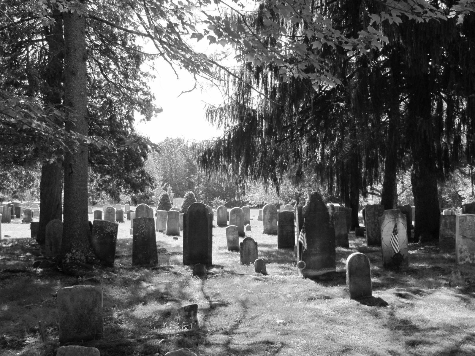
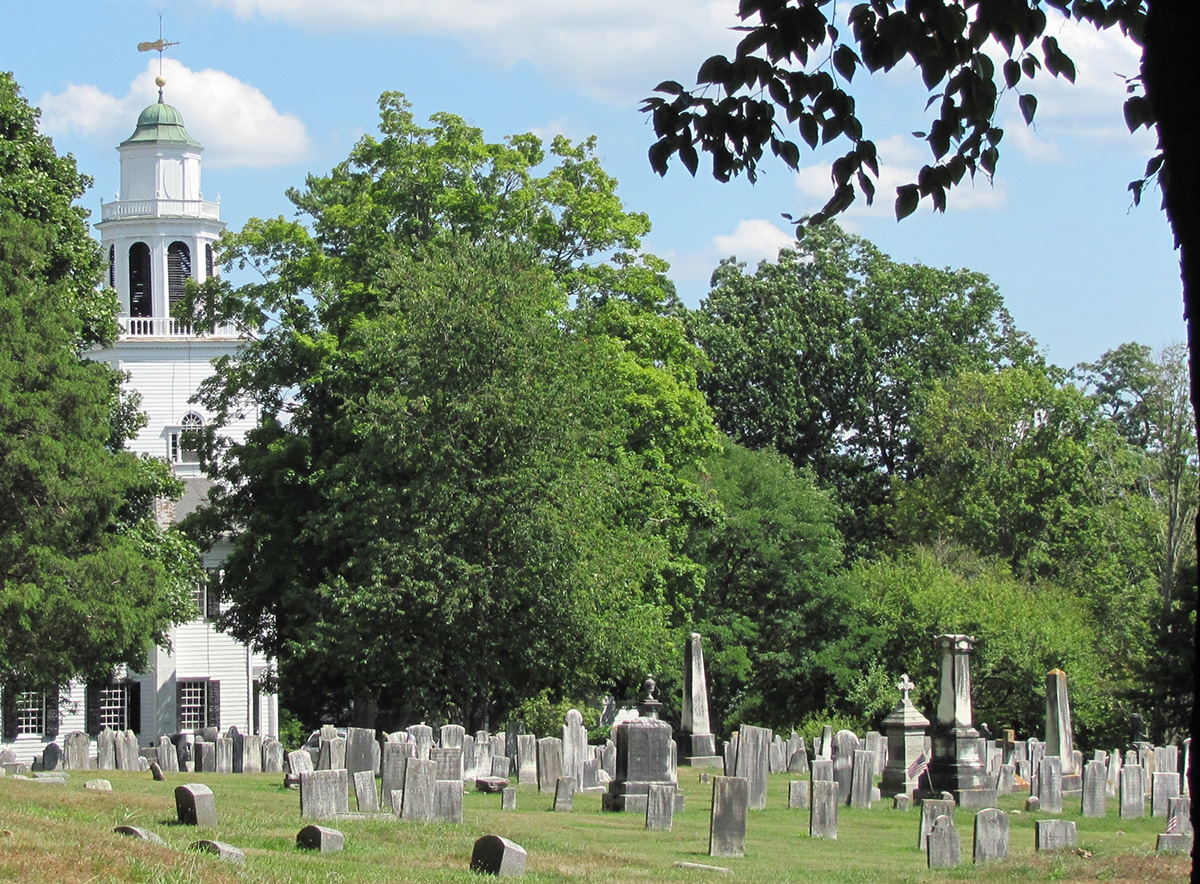
Church on the Hill Burying Ground dates to the mid-18th century and the earliest days of settlement in the Town of Lenox. Located at the northern end of the village atop a steep incline, the burying ground and adjacent church appear as sentries, watching over the town below. The burying ground is the oldest known public place of interment in Lenox, holding the remains of some of the first settlers and builders of this rural Berkshire community. In the late 1990s, concern emerged regarding the long-term health of the burying ground. Despite earning a spot on the National Register of Historic Places in 1981, the property's physical condition had seriously declined. In 2012, the Lenox Historical Commission commissioned Martha Lyon Landscape Architecture, LLC and Monument Conservation Collaborative, LLC to prepare a preservation plan for the burying ground. Content included historical research and documentation, landscape assessment, and recommendations for treating the 240-year-old historic site. In 2013, Lenox's Community Preservation Committee awarded funds for the first phase of implementation, conservation of the burying ground's most hazardous gravestones and monuments.
Northampton's Bridge Street Cemetery extends across 14 acres on the east side of the city, across from the historic Tri-County Fairgrounds. Established on one acre in ca. 1661, it holds the interments of the city's early settlers, as well as families influential in the city's growth and development. Located within the dense urban Ward 3 neighborhood, it doubles as a public park where neighbors stroll along grassy roads and under the shade of mature trees. Beginning in early the early 2000s, residents of Ward 3 voiced concern about the cemetery's overall appearance, including its perimeter chain link fence, leaning gravestones, and decaying tombs, and urged the city to address the situation. In response, Northampton hired Martha Lyon Landscape Architecture, LLC to study all of the cemetery's features and develop a step-by-step preservation approach. Working with Monument Conservation Collaborative, LLC (stone conservators) and CME Associates, Inc. (structural engineers), MLLA compiled a series of thirteen projects that would restore the cemetery landscape on an incremental basis. Replacement of the chain link perimeter fence with ornamental iron emerged as the highest priority project.
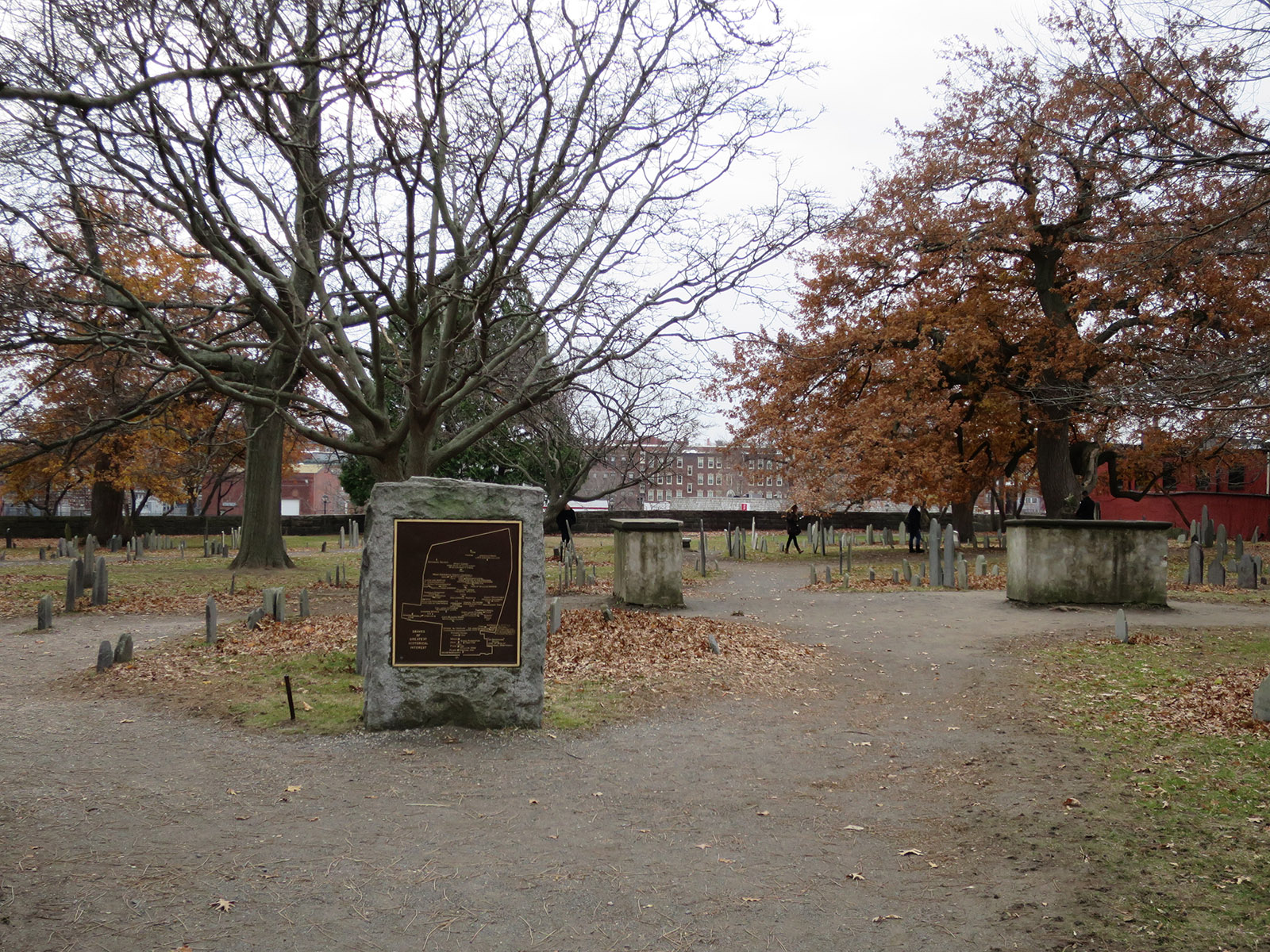
The Charter Street Cemetery is Salem's oldest known place of interment and the resting place of several prominent early settlers. Each year, thousands of visitors walk among the hundreds of intricately carved slate tablet markers, making the one-acre burying ground one of Salem's most popular tourist attractions. This heavy foot traffic has resulted in soil compaction, tree damage, and degradation of gravestones, making the landscape appear tired and worn. To address the cemetery's condition, the City of Salem hired Martha Lyon Landscape Architecture, LLC to prepare a plan to restore the entire cemetery landscape. Included in the plan are tree removals and replacement with new tree species; fence restoration and replacement; upgrades to the two cemetery entrances; and construction of a looping walkway leading to all corners of the cemetery. Subtle in-ground lighting, placed along the north and south edges, will provide ambient illumination and, at the same time, upgrade visibility within the cemetery.
The Old North Burying Ground dates to 1634 and the early establishment of the Town of Ipswich. Located on High Street, it holds the burials of many prominent citizens including settlers and individuals who developed the town, marked by artfully carved slate tablet markers or placed in private tombs. Lack of easy access to the burying ground, combined with its over 380-year age, have posed difficulties for maintenance crews and as a result, the mature trees, retaining walls, pathways and gravestones show signs of wear. The Town of Ipswich hired Martha Lyon Landscape Architecture, LLC and Fannin-Lehner Preservation Consultants to develop a master plan for preserving this historic landscape. Included were assessments of all landscape features, phased recommendations for preservation treatment, and management plan. Highest on the list of treatment priorities were the removal of dying sugar maple trees, stabilization of private tombs, and re-surfacing of a central pathway.
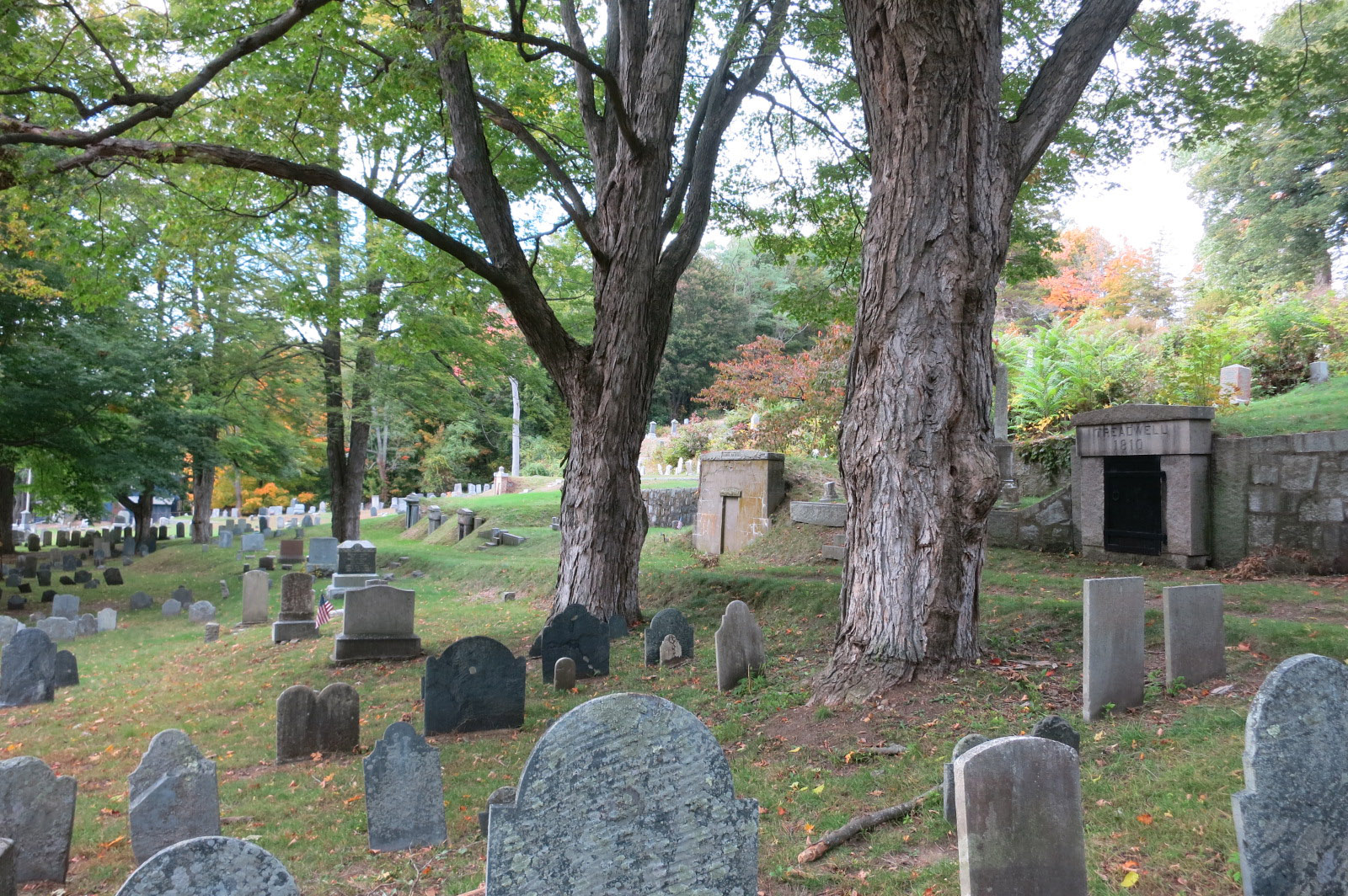
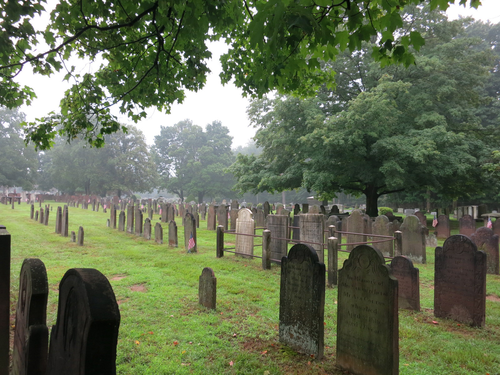
Established in 1703, the Longmeadow Cemetery lies adjacent to the First Congregational Church in the center of the Town of Longmeadow. Begun as a small Colonial style burial ground, the cemetery gradually grew in size, and with each addition of land, exhibited a new cemetery style. Today the cemetery extends across 7.8 acres, with a patchworked landscape of Colonial, Victorian and Modern designs. The cemetery's owners, the Longmeadow Cemetery Association, saw the need to enhance each of the styles and at the same time knit them together into one cohesive landscape. They commissioned Martha Lyon Landscape Architecture, LLC to prepare a master plan that assessed edges, views, the condition of trees, fencing and other landscape features, and proposed a set of upgrades to be implemented over time. The trustees opted to enhance the two cemetery entrances first, and this effort is now in progress.
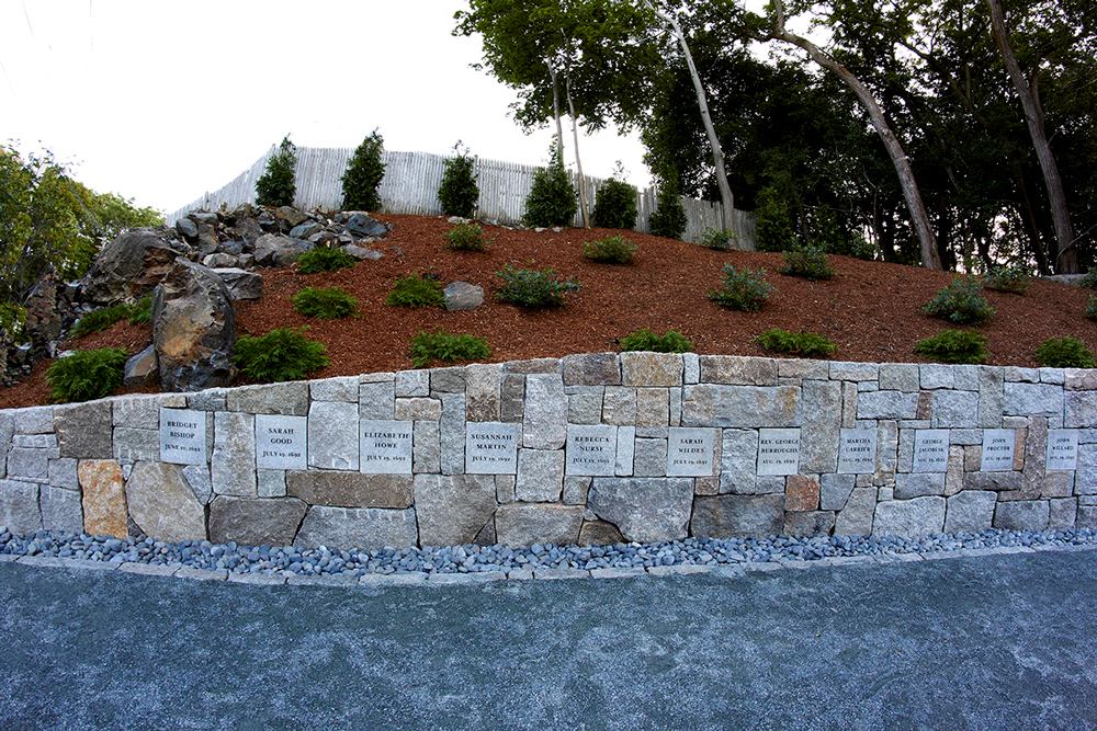
In late 2015, a team of historians and geographers determined the precise location of the Salem witch trial executions. In the summer of 1692, nineteen women and men were hanged following the accusation and conviction of practicing witchcraft. The site, known as Proctor’s Ledge, stood outside the Village of Salem, on a rocky outcrop. Salem had purchased the land in the 1930s, but until 2015, had not made an effort to improve the site. In early 2016, Martha Lyon Landscape Architecture began work on the design of a memorial at Proctor’s Ledge. The process involved extensive interaction with the local residents of the surrounding area, as well as Salem tourism organizations and descendants of the victims. The resulting design took the form of a crescent-shaped granite block retaining wall, set into the ledge’s slope, creating an intimate plaza. Nineteen stones, one for each victim, were inscribed, with small lights placed below each to shine up on the stones at night. A single white oak, planted at the edge of the plaza, symbolized the tree used in the execution. Native trees and shrubs, including shadblow serviceberry and aromatic sumac, rim the back and sides of the wall. Dedication took place on July 19, 2017 with nearly 500 in attendance. <a style="color:#dc9325;" href="https://www.bostonglobe.com/metro/2017/07/19/salem-dedicates-witch-trials-memorial-marking-years-since-infamous-executions/XLqBAGswPR8v13yePlBGhM/story.html">Newspapers</a> across the United States covered the story as did <a style="color:#dc9325;" href="http://www.wbur.org/artery/2017/07/19/proctors-ledge-memorial-salem">National Public Radio (WBUR),</a> <a style="color:#dc9325;" href="https://www.smithsonianmag.com/history/site-salem-witch-trial-hangings-finally-has-memorial-180964049"><i>Smithsonian Magazine,</i></a> and <a style="color:#dc9325;" href="http://www.landscapeonline.com/research/article-a.php?number=29654"><i>Landscape Online.</i></a>
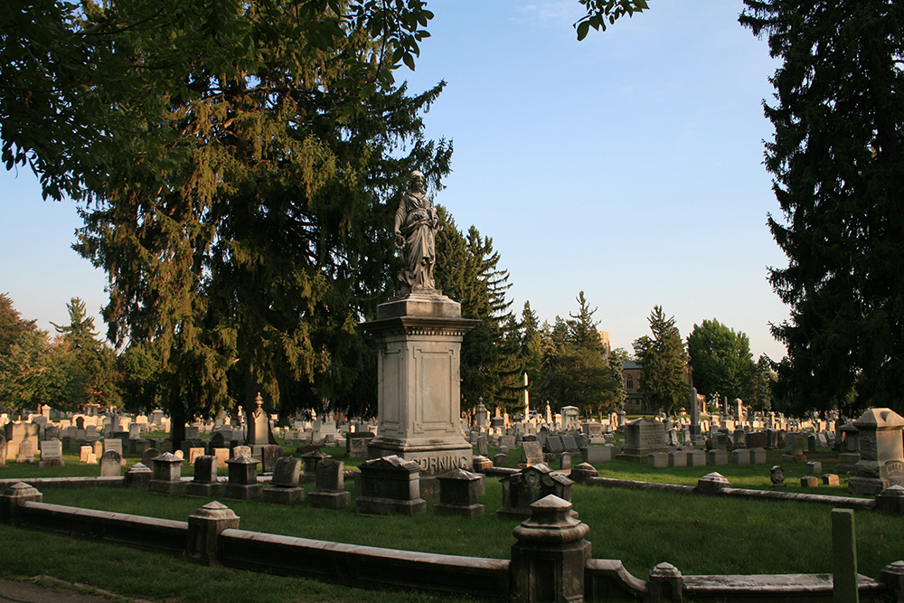
Mount Hope Cemetery lies in the heart of the City of Rochester, along the east bank of the Genesee River. Founded in 1838, it is the oldest municipally-owned cemetery in America designed in the "rural cemetery" style, with its 197 acres extending across a post-glacial landscape covered with mature specimen trees. Dating to the early days of settlement in western New York State, Mount Hope contains the burials of pioneers, industry leaders, and city officials, as well many members of the city's less fortunate populations. Among its most important features are the gravesites of abolitionists Susan B. Anthony and Frederick Douglass. In 2016, the city hired Martha Lyon Landscape Architecture to prepare a National Register of Historic Places nomination for the cemetery's entire 197 acres. Working in collaboration with architectural historians at Landmark Consulting, MLLA researched the property's history, compiled a detailed map, photographed its buildings, monuments and landscape features, and wrote the detailed nomination. In September 2017, the New York State Historic Preservation Office approved the nomination, and sent it on to the National Park Service for final listing.
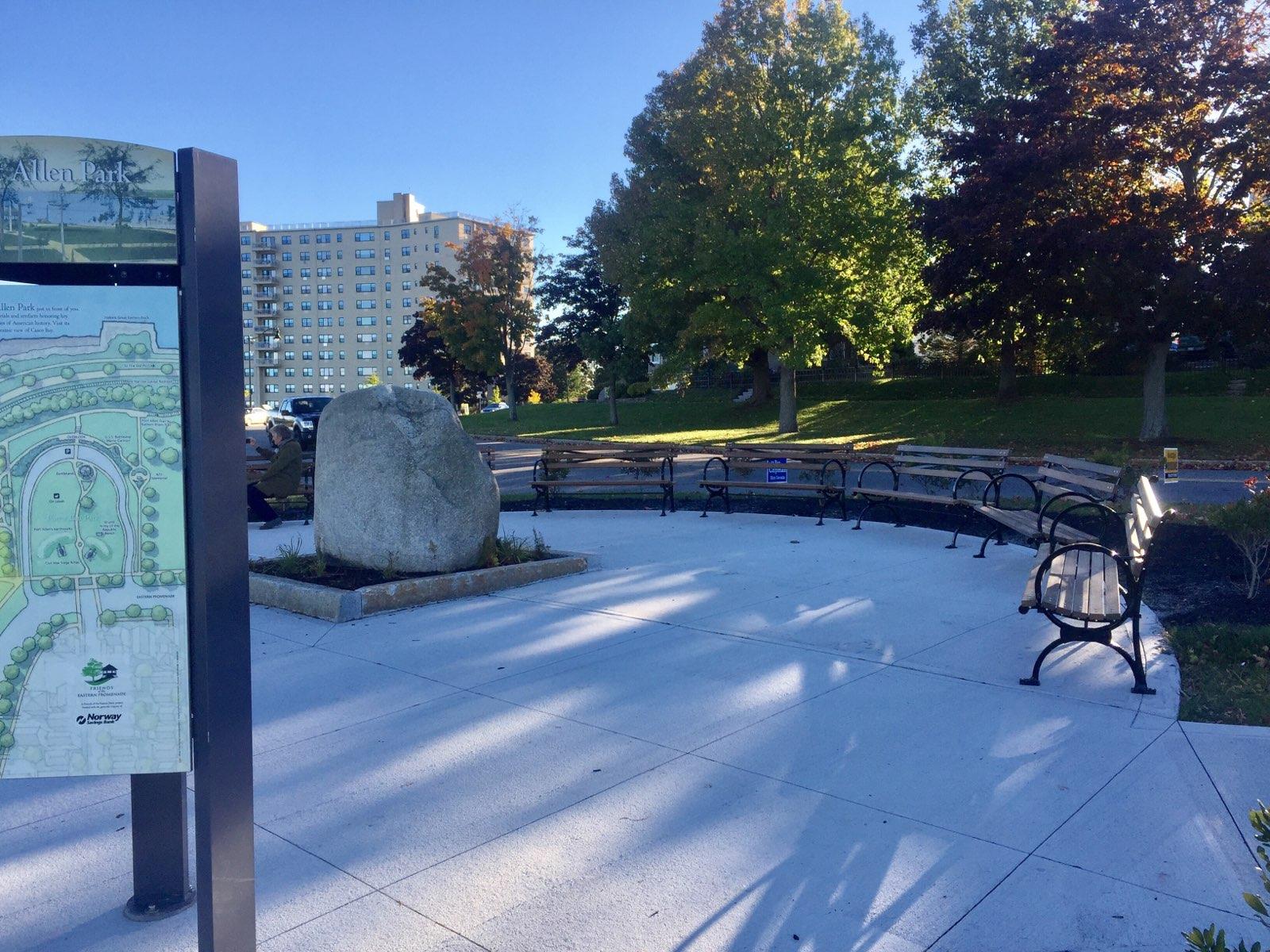
In October of 1918, Portland native Corporal Jacob Cousins was killed in France near the German border leading his platoon during World War I. His death marked the first in what would be many for Jewish American soldiers nationwide during this and other conflicts to follow. In 1935, the city placed a commemorative boulder and bas relief style bronze plaque at the edge of the Eastern Promenade to recognize Cousins' sacrifice. Over the course of 75 years, the memorial became overgrown with barberry and rhododendron shrubs, and could not be easily accessed from adjacent streets and sidewalks. By 2010, vegetation all but obscured this important Portland landmark. In 2016, Martha Lyon Landscape Architecture worked with the city and non-profit Friends of the Eastern Promenade to design a more dignified setting for the memorial, and one that increased access to the boulder and bas relief. MLLA relocated the boulder at the center of a new plaza, designed to double as a northern entrance to the abutting Fort Allen Park. Completed in the summer of 2018, the semi-circular space is rimmed with native bayberry shrubs and contains seven dedicated benches as well as the Cousins memorial boulder, all oriented toward the east and views of Casco Bay. Formal dedication took place on Veterans' Day weekend.
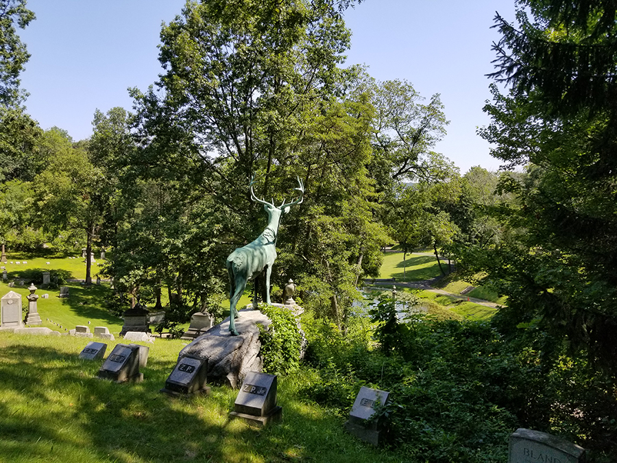
Established in 1853 and designed by landscape architect Howard Daniels in the “rural” style, Riverside Cemetery encompasses 36.4 acres along the steep west bank of the Naugatuck River in downtown Waterbury. A central stream flows downward from the west cemetery edge, filling three ponds before eventually reaching the Naugatuck. Family plots marked with large central monuments step up the tiered slopes. Locally produced brass and bronze appear in several of the monuments, including a full-size elk sculpture standing on a high point watching over the landscape. Riverside Cemetery was listed on the National Register of Historic Places in 1988. Privately owned and operated, the cemetery has provided interment space to the people of Waterbury for over 170 years, yet over the past several decades, Riverside has become increasingly burdened by a lack of available interment space. Nearly all in-ground plots have been sold, and revenue from plot sales is rapidly diminishing. To address this shortage, the Trustees of Riverside Cemetery hired MLLA to identify sites within the existing landscape that could accommodate expansion. The resulting Space Utilization Plan located six such sites and illustrated how each could be altered to hold both in-ground and columbarium niches for cremated remains. MLLA designed each site to blend with the existing historic landscape.
Established in 1807 as a small burial ground for families in the north part of Salem, Greenlawn grew, over the course of several decades into a 55.8-acre modern cemetery. With each addition of land, Greenlawn introduced a new cemetery design, resulting in a patchwork of colonial, rural, garden, and lawn styles tied together by a network of roads and paths organized around two ponds. In the 1930s, a local plantsman, Harlan Kelsey, proposed an arboretum for Greenlawn, and imported hundreds of tree and shrub species to ornament the landscape, portions of which survive today. Surrounded by roadways, a dense urban neighborhood and a private golf course, the cemetery cannot expand in size and as of 2020, available gravesite space was near depletion. Greenlawn is Salem’s only active public place of interment. To address this lack of interment space and the overall condition, the City of Salem hired Martha Lyon Landscape Architecture, LLC to prepare a master plan for Greenlawn’s landscape. Guided by an extensive public engagement process, the plan established a vision, documented the property’s history, and assessed its existing landscape conditions, including the stormwater system, ponds, and tree population. MLLA identified thirteen areas within the cemetery where new interments could be added, in the form of in-ground full-casket burials, in-ground and columbarium cremation niche burials, and scattering gardens, all designed to meld with the historic landscape.
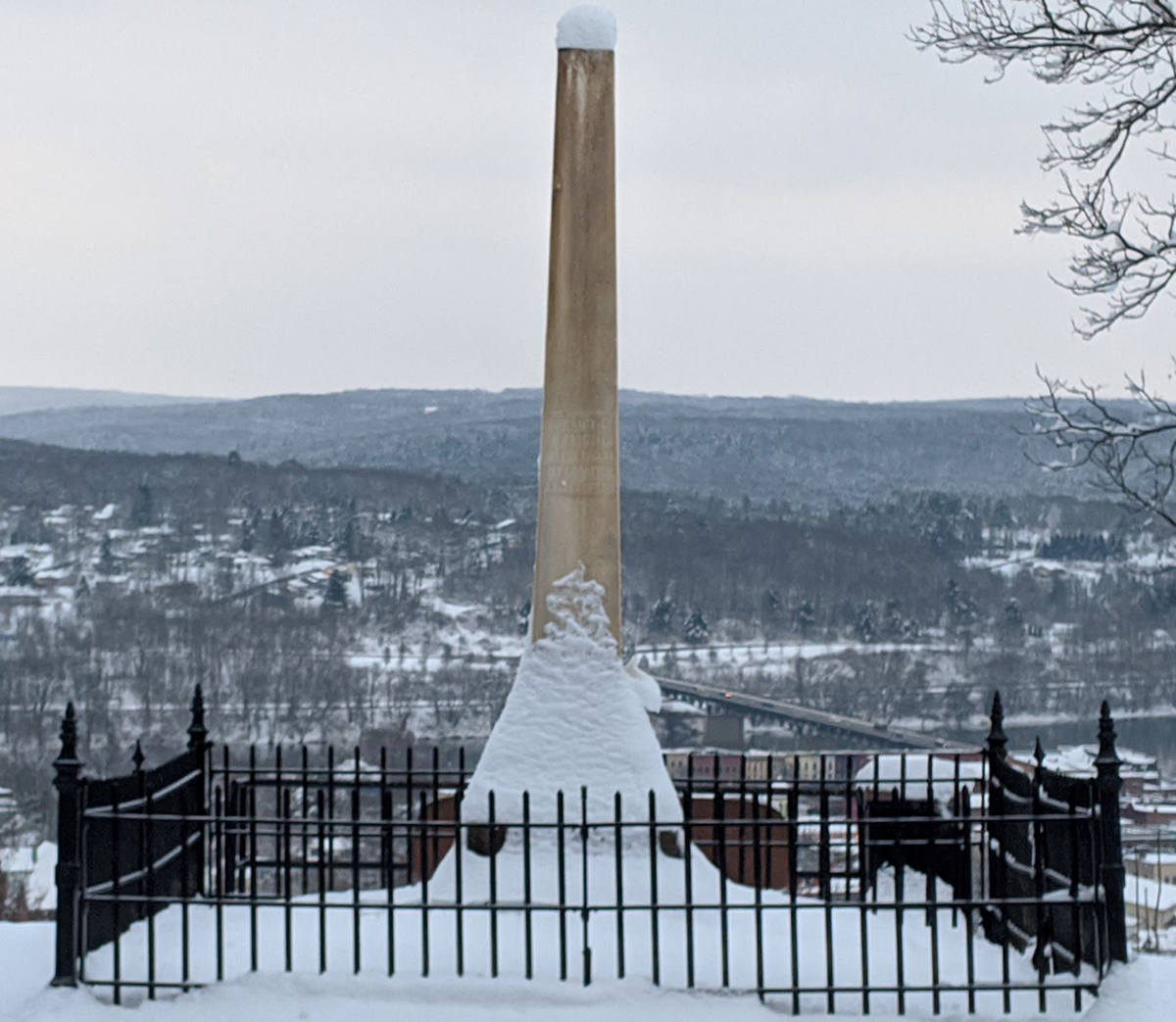
Established in 1851 as a nondenominational burial ground accessible to all citizens, Evergreen Cemetery covers 60.85 acres in the Village of Owego, part of the Town of Owego, in Tioga County, New York. The property lies along the south slope of East Beecher Hill and overlooks the village, Owego Creek, and the Susquehanna River. Designed in the rural cemetery style, its features include gently rolling, tiered topography, an array of tree and shrub species, and monuments and markers of many different materials, sizes and styles. The graves of many of Owego’s citizens, both prominent and lesser known, appear throughout and help to document over 150 years of town history. To officially recognize its importance, the village nominated Evergreen Cemetery to the National Register of Historic Places and achieved the honor in 2002. Over the past twenty years, Owego residents have become increasingly concerned about the cemetery’s condition. While crews have continued to mow lawns, the property’s age, combined with ongoing exposure to harsh weather, has led to deterioration. Complicating this condition is the lack of funds to develop existing cemetery land for new interments. In response, the village established an Evergreen Cemetery Committee (ECC) that identified the need for a Cultural Landscape Report, a comprehensive document that established priorities for preserving the landscape over the long-term. Martha Lyon Landscape Architecture, LLC worked with the ECC over twelve months to create the CLR. Tasks included researching and documenting Evergreen’s historical development, assessing existing conditions, and devising recommendations for twelve treatment projects.
The modest, spare green space located at the far northern end of Newport’s Old Common Burying Ground known as God’s Little Acre (GLA) holds the largest known collection of colonial era slave burials in the United States. While slate, marble and granite stones stand at many of the graves, many other interments remain unmarked. Care of the property, including the trees, lawns, and gravestones, has been capably managed by City of Newport crews, however the extent of care over the past decades has been limited due to lack of funding. Newport’s citizen-based Historic Cemetery Advisory Committee took notice of GLA’s condition and launched an effort to begin preservation efforts. Concurrently, a private citizen established the God’s Little Acre Preservation Project (GLAPP), a foundation to support the work of the city. In 2020, GLAPP hired MLLA to prepare a landscape preservation plan for GLA. MLLA researched the history of the property and documented its physical development over time, and assessed the existing landscape conditions. Treatment recommendations included improving entrances, upgrading the perimeter enclosure, removing diseased and dying trees, and clarifying vehicular circulation around the property. MLLA also advised GLAPP on the selection of a qualified stone conservator to complete an inventory and assessment of the gravestones.
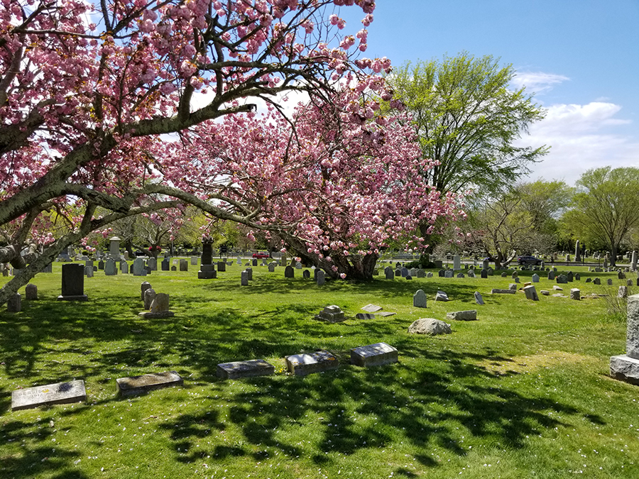
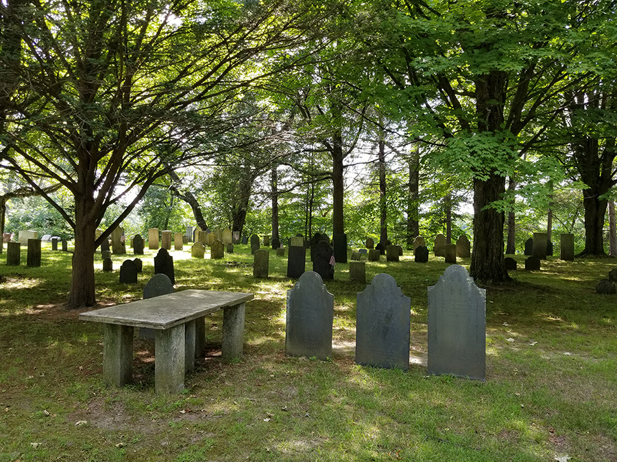
Established ca. 1714, Riverside Cemetery is Sunderland’s oldest known place of interment, situated on land reserved of the town’s first permanent settlement along the east bank of the Connecticut River. The 5.91-acre landscape contains the graves of Sunderland’s founders, generations of farmers, and others influential in the development of the town. Still an active cemetery, Riverside’s several burial sections date from the early 18th to the 21st centuries and exhibit a range of historic cemetery styles. Its hundreds of monuments and markers tell the 300-year history of this early Connecticut Valley farming community. While the landscape has been conscientiously managed by its governing board of trustees, the property lacked space for future burials. The trustees wanted to find additional interment space while at the same time preserving the cemetery’s historic features and overall character. In 2018, the trustees hired Martha Lyon Landscape Architecture, LLC (MLLA) and Monument Conservation Collaborative, LLC (MCC) to prepare a preservation master plan. The team assessed existing conditions and provided preservation recommendations for the trees, roads, paths, edges, monuments and grave markers. Included in the plan were options for creating additional burial space by closing unused roads and making cremation gardens. Implementation will begin in 2019.
Established in 1854 by Irishman Patrick Denvir, a Charlestown-based undertaker, Catholic Mount Auburn Cemetery is one of the Boston area’s first cemeteries created to serve its growing Catholic population. Located in Watertown at the terminus of Cottage Street, the 6.84-acre property holds the remains of thousands of predominantly Irish immigrants and their children, a majority interred during the last decades of the 19th century. While the original layout allegedly provided for 5,361 burials, it is likely that the cemetery contains between 16,000 and 23,000 interments. Referred to early on as “Calvary Cemetery” and “Sand Banks,” the cemetery is known today as Catholic Mount Auburn, reflecting its location near Mount Auburn Street, and the beautifully stewarded and preserved Mount Auburn Cemetery, bordering on the east, south, and west sides. Despite its significance in the history of Boston’s Catholic community, Sand Banks fell into a state of disrepair, receiving minimal care throughout the 20th century. To address this, the property’s manager, Catholic Cemetery Association of the Archdiocese of Boston (CCA), set aside funds to develop a landscape master plan and hired Martha Lyon Landscape Architecture, LLC to oversee the effort. MLLA researched the cemetery’s history, assessed existing conditions, and developed a treatment plan for restoring the landscape. Central to the plan was a proposal to provide a more dignified setting for Sand Banks, achieved by improving the main entry gates, and upgrading the boundary between Sand Banks and Mount Auburn Cemetery.
