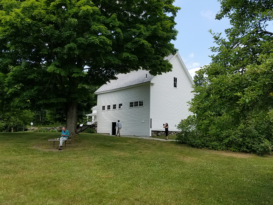
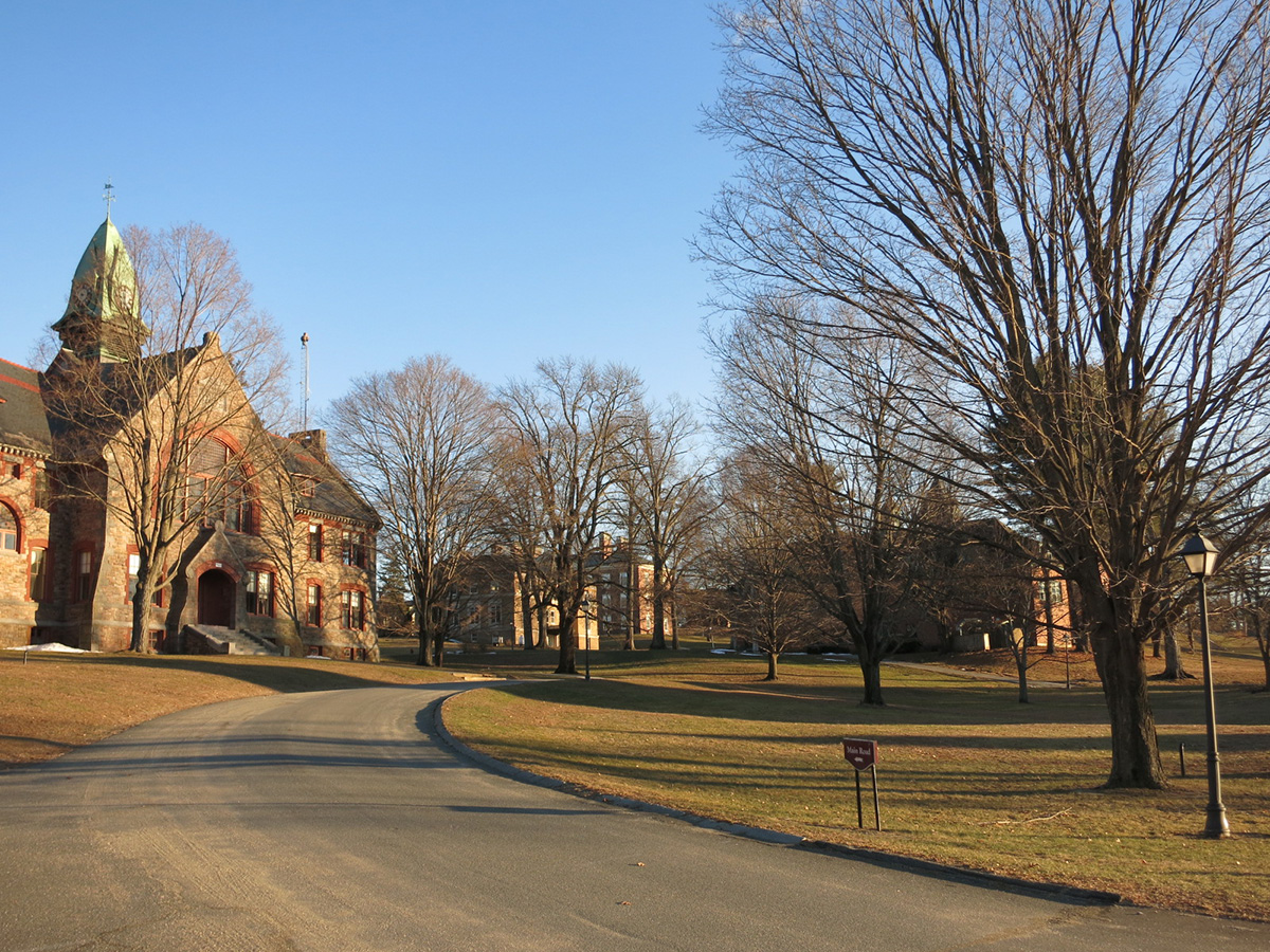
The Town of Holden lies on the northern edge of the central Massachusetts City of Worcester. Settled in the mid-1700s as a farming community, Holden later developed into a major industrial center, housing many mills along its several rivers and streams. After mill activity waned in the 20th century, the town developed into a bedroom community for nearby Worcester and Boston. In 2007, Martha Lyon Landscape Architecture collaborated with Community Preservation Associates and Earth Tech, Inc. on a comprehensive master plan for Holden. MLLA inventoried, assessed and made recommendations for preserving the town's historic and cultural resources. A major plan recommendation was preservation and sensitive redevelopment around the historic Holden Common, established as a public green space in 1839.
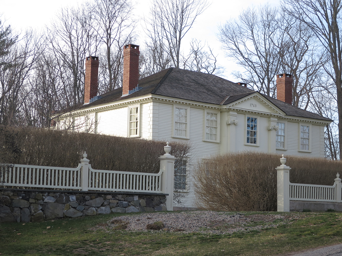
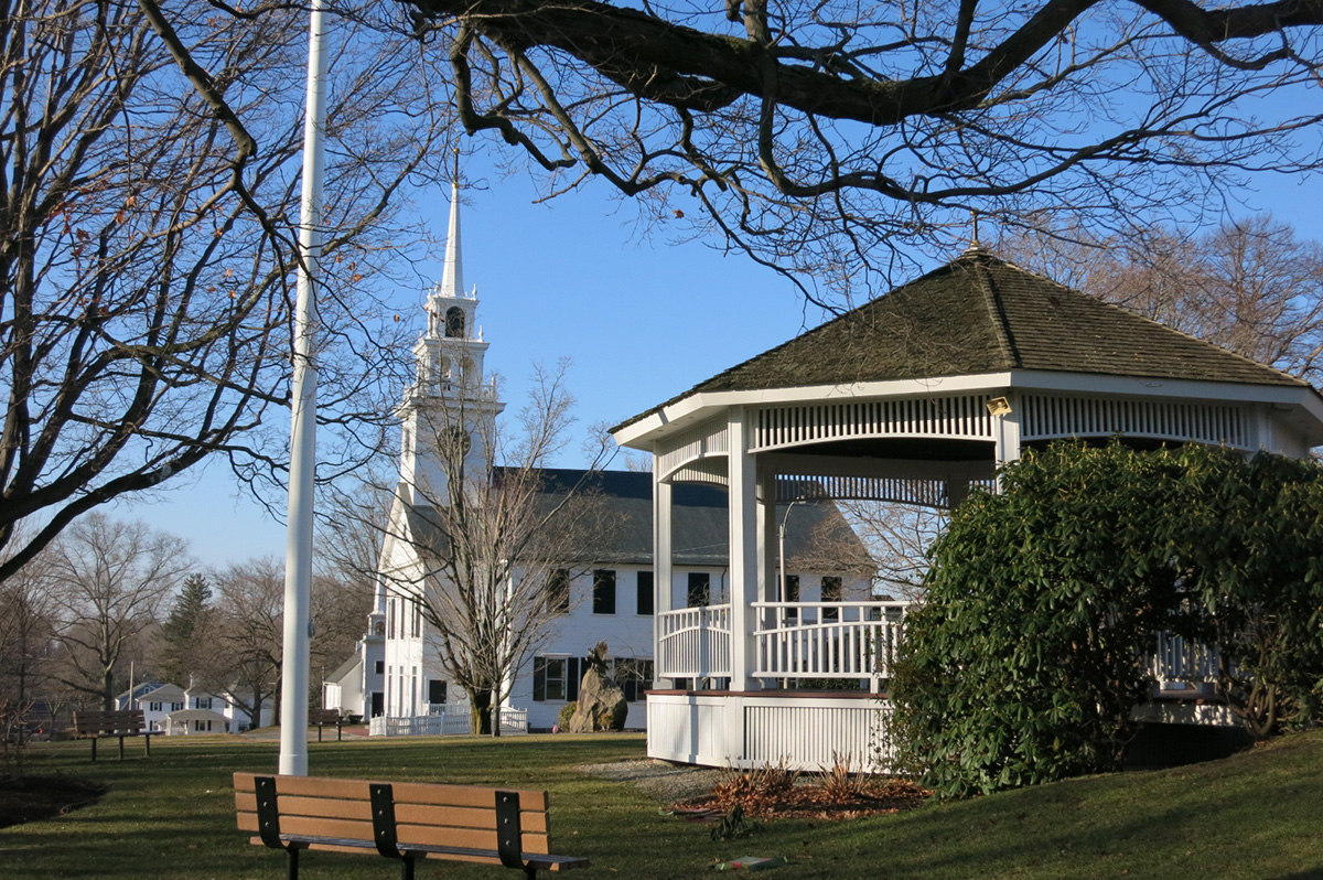
Amherst is one of New Hampshire's oldest towns, settled in the early 1700s along the Souhegan River (west of the Merrimack) as a farming community. What is believed to be the state's oldest public burial ground lies behind the Town Hall. In the late 1700s and early 1800s, Amherst was the most prosperous town in southern New Hampshire, serving as a major transportation hub and shire town. But unlike nearby towns along the Merrimack, Amherst never became industrialized, and as a result has retained its Georgian, Federal and Greek Revival buildings surrounding its central village green. In 2007, Martha Lyon Landscape Architecture was hired with Community Preservation Associates and Earth Tech, Inc. to prepare a comprehensive master plan for Amherst. The town, now a bedroom community for Manchester, Concord, Nashua, and Boston, is under tremendous pressure to grow. To help plan for that growth, MLLA inventoried, assessed and made recommendations for preserving the town's historic and cultural resources.
Medfield's downtown dates to the mid 1600s, and the first settlement of the town. Over the town's 350-year history, the main four corners have served as the commercial and civic core. In 2005, the town hired Martha Lyon Landscape Architecture and a team of professional planners to create a vision for improvements to the downtown. The project included design workshops for the citizens and merchants of Medfield and the sharing of information about the visioning process through the town's website. The Visioning and Action Plan included recommendations for future land uses, zoning changes, and streetscape improvements, all designed to restore historical elegance, upgrade vibrancy, and encourage greater public use of the downtown.
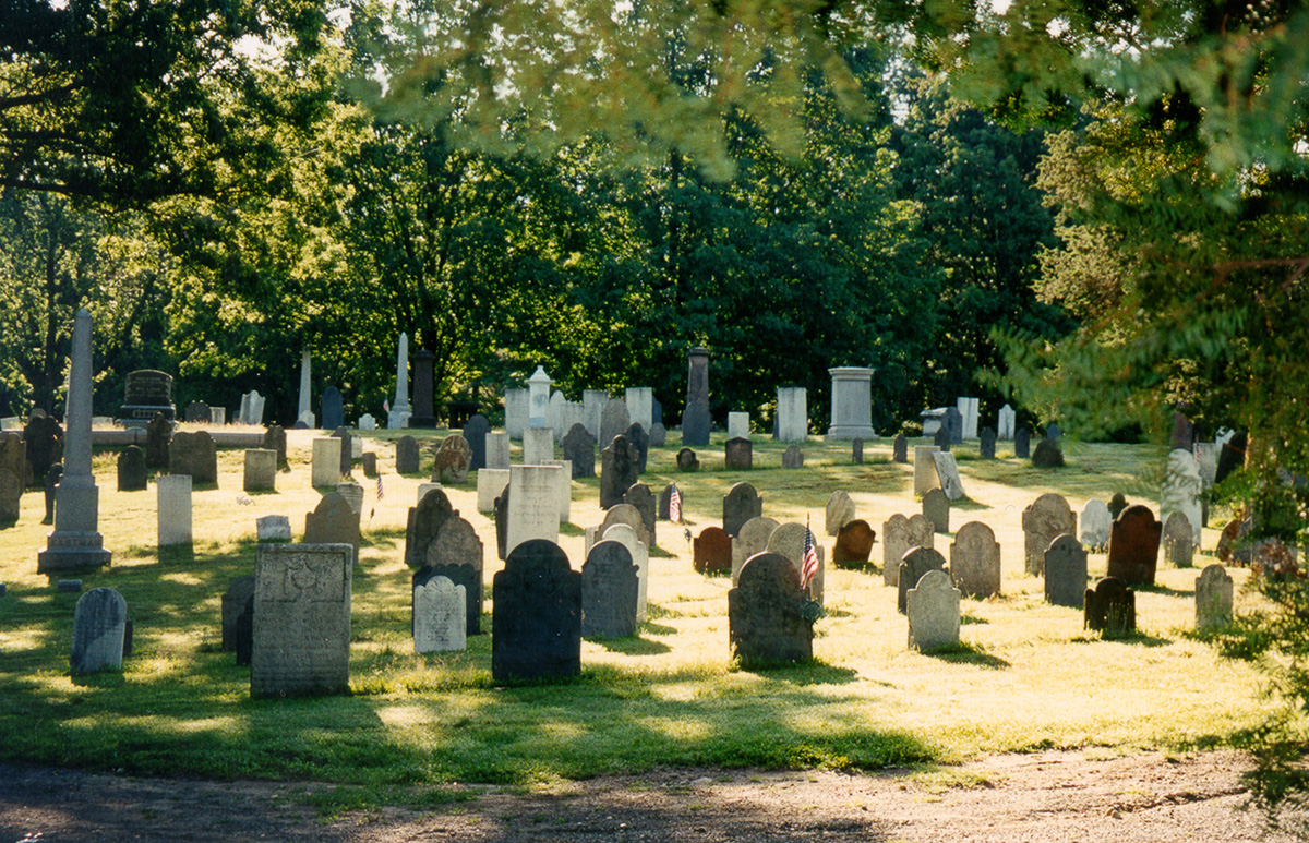
Since its inception in the early 1970s, the Amherst Historical Commission has completed many preservation efforts, including a 1,000-property inventory, nine National Register Historic Districts, a preservation plan for West Cemetery, and a Demolition Delay Bylaw. In preparing for the town's 250th anniversary in 2009, the commission wanted to understand all of Amherst's preservation needs, and create a plan for addressing them. Working with the planning firm of Giezentanner Associates, Martha Lyon Landscape Architecture prepared this ten-year plan. The plan summarized Amherst's history, reviewed its remaining historic and cultural resources, and assessed the public's perception of past and current preservation efforts. Recommendations outlined specific preservation activities, estimated their costs, and identified potential sources of financial support.
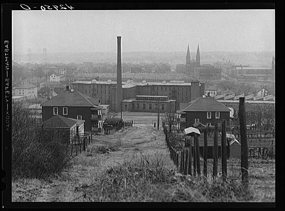
The City of Fall River lies along the east bank of the Taunton River, at its confluence with the Quequechan. Settled in 1680 as a farming and fishing community, Fall River developed in the 19th century into one of the nation's major industrial centers. By 1910, the city was the largest producer of textiles in the country, with 43 corporations, 222 mills, and 3,800,000 spindles. Following the Depression, the textile industry moved south, and Fall River's economy waned. City leaders began to explore new concepts for reviving the economy, including capitalizing on Fall River's historic and cultural resources, and re-developing the remaining mill structures and complexes. Between 2007 and 2009, Martha Lyon Landscape Architecture collaborated with Community Preservation Associates and AECOM, Inc. on a comprehensive master plan for Fall River. MLLA inventoried, assessed and made recommendations for preserving the city's historic and cultural resources. Major plan recommendations included marketing Fall River as a tourist destination; supporting and fostering growth of the city's cultural organizations; preserving the city's historic architectural and landscape architectural resources; and improving the visitor's first impressions of the city.
Established in 1647 along the north bank of the Piscataqua River, this coastal community has long been home to prominent military sites, maritime industries and lovers of the sea. The town's two historic forts, located at the mouth of the Piscataqua have protected the coastline, and Kittery's lighthouse and lifesaving station have guided and rescued sailors and fishermen. The area's large supply of timber fostered an early shipbuilding industry that evolved into the Portsmouth Naval Shipyard, a 216-year old site that still operates today. And the town's windswept beaches, winding estuarine creeks and upland forests have inspired the work of well-known poets, writers and artists for centuries. In an effort to retain this character, while at the same time allow for growth in housing and economic activity, Kittery commissioned a twenty-year comprehensive master plan. Throughout 2016, Martha Lyon Landscape Architecture, LLC collaborated with a team of consulting planners and the people of Kittery to craft this plan. MLLA inventoried, assessed and made recommendations for preserving the town's historic, cultural, natural, open space and recreation resources. Major plan recommendations included preserving both historic and natural resources through improved stewardship of historic properties, as well as through revisions to development regulations that will ensure landscape and view protection.
Established in 1662 along the southern bank of the Neponset River, Milton has, over its 350-year history, grown from a small industrial village into a modern, largely residential suburb of the neighboring City of Boston. The town housed the first paper mill in New England, first commercial railroad in America, and first commercial operation to institute the profession of floriculture. It has also been home to many prominent Boston-area citizens, including merchants and several Massachusetts governors, and many of the grand homes and estates of these individuals and families still stand. The sprawling Blue Hills Reservation, the largest protected open space in Metropolitan Boston, fills Milton's southwest corner. In an effort to retain the town's character, while at the same time allowing for growth in housing and economic activity, Milton commissioned a twenty-year comprehensive master plan. Throughout 2014, Martha Lyon Landscape Architecture, LLC collaborated with a team of consulting planners and the people of Milton to crafting this plan. MLLA inventoried, assessed and made recommendations for preserving the town's historic, cultural, natural, open space and recreation resources. Major plan recommendations included preserving both historic and natural resources through improved stewardship of historic properties, as well as through the development of a conservation strategy for long-term protection of open space.
Northfield is the northernmost settlement in Massachusetts on the Connecticut River, and the only town that spans the river. A centuries-long home of the Native Squakeag tribe, the town was permanently established by Europeans in ca. 1713, who cultivated its alluvial soils and established a village along a two-mile long "Town Street." World renowned spiritual leader Dwight Lyman Moody was born in Northfield, and in the late 19th century founded the Northfield School for Young Ladies, as well as the Mount Hermon School for Boys (located five miles to the south, in Gill). Moody's birthplace, homestead and burial site draw thousands of visitors per year. In 2005, the Northfield and Mount Hermon Schools (NMH) consolidated into one Gill-based facility, and all operations moved out of Northfield, vacating the campus. NMH sold the campus, raising local concern about the property's long term use. The need for a comprehensive master plan emerged -- one that would help the town guide future growth and development, including activity in and around the former campus. Throughout 2013, Martha Lyon Landscape Architecture, LLC and a team of consulting planners worked with the people of Northfield on a twenty-year comprehensive master plan. In addition to managing the project, MLLA inventoried, assessed and made recommendations for preserving the town's historic and cultural resources. Major plan recommendations centered on developing Northfield as a center for heritage, recreational, and agri-tourism, balancing preservation of historic and natural resources with increased economic activity.
Established in the early 1600s as a farming community along the Charles River, Medfield evolved, in the 20th century, into a major Boston suburb with a highly-rated public school system. Residential subdivisions replaced farmland, and the main street, Route 109, became a congested thoroughfare. The Medfield State Hospital, established in the late 19th century at the northern end of the town was a major employer until its closure in the 1990s, eradicating jobs and leaving a sprawling historic campus unoccupied. Concerned about safeguarding its history, natural resources, and local economy, and addressing a lack of affordable housing and the needs of its growing population of older adults, Medfield commissioned an update of its master plan. As part of a larger professional team, Martha Lyon Landscape Architecture, LLC inventoried, assessed and made recommendations for preserving the town’s historic, cultural, natural, open space and recreation resources. Major plan recommendations focused on increasing heritage tourism and cultivating the local arts community, and continuing to protect open space and natural resources.
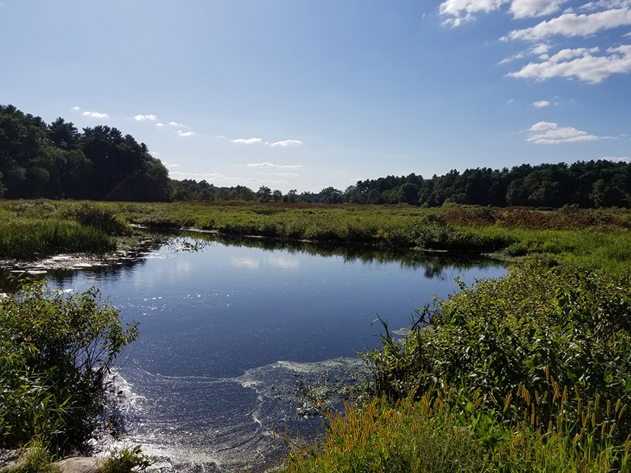
Located in southern New Hampshire less than twenty miles north of the Massachusetts border, the one-time small village of Scots-Irish immigrants has grown into a 34,000-resident suburb of Manchester, Concord, and most recently, Boston. The childhood home of astronaut Alan Shepard and temporary residence of Robert Frost and family, Derry harbors a rich history tied to the town’s natural resources. Early industries including flax cultivation and production of linen, followed by shoe manufacturing and commercial dairying. Derry’s rolling topography interspersed with brooks and ponds, supported these economic pursuits. In an effort to retain a sense of history and protect natural resources while at the same time accommodating the needs of a growing population, Derry moved to update its comprehensive plan and hired a professional planning team to do so. Martha Lyon Landscape Architecture, LLC oversaw the historic, cultural, natural, open space, and recreation elements of the plan, inventorying existing conditions and developing strategies for managing the resources over time.